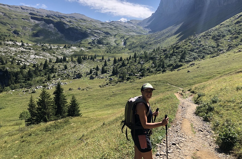
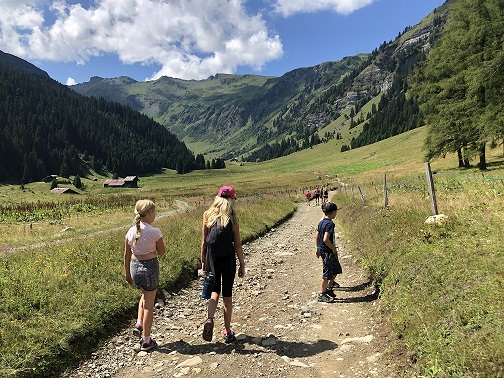
Samoens and the Haute Giffre valley really is a walkers' paradise in summer. Whether you wish to take a gentle stroll along the banks of the River Giffre or go out on a few days serious hiking and climbing up from 700m to 3100m altitude, it truly offers it all.
The trails are signposted and with around 900km of marked trails, you are spoilt for choice. We highly recommend taking maps and books available in our accommodation or from the Tourist Office. Guides can be arranged locally in Samoens.
Here are a selection of our favourite walks in the area, but there are so many more to choose from!
Time: 1.5hrs
Altitude Gain: 79m
A great circular walk on wide easy to follow tracks. This walk takes you from the Lacs aux Dames in Samoens through gentle woods, and along the banks of the Giffre river to Lac Bleu in Morillon. Look out for lots of paths forking off the main trail which are great to explore! Refreshments available at both lakes!
Time: 1hr
This is the beautiful waterfall you can see from Samoens village, and it just so happens that a short, easy walk gets you up close and personal! Make your way to the road bridge which crosses the Giffre river just beyond the Grand Massif Express gondola, and then take the left hand track which runs parallel with the river. Follow this track for around 400m and then look out for a large stream on your right, which you follow towards the waterfall. The path is tricky to see initially, but after a few metres it becomes very obvious.
Time: 1hr 15mins
Altitude Gain: 79m
This is a firm favorite with the Alps Accommodation team and offers truly stunning views at the end of a relatively easy, child friendly walk. Drive up to the Col de Joux Plane and park at the lake, then follow the well marked track which traverses around the mountain to peak of the Bourgeoise (look out for the big wooden cross!). To make the most of the views make sure to go on a clear day, and remember your camera!
For a half day walk, you can also access this trail from just behind the Church in Samoens centre.
Time: 1hr 15mins
Altitude Gain: 174m
This is a lovely walk to explore higher in the mountains, ending at a beautiful lake with stunning views. Take the Grand Massif Express to Samoens 1600 and then make your way to the car park on the slightly higher plateau, from which the walk is well sign posted and follows a wide track.
Time: 2hrs
Altitude Gain: 110m
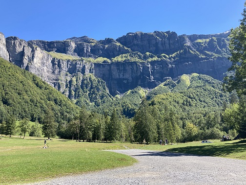
The Cirque du Fer-à-Cheval area has to offer some of the stunning mountain scenery there is. Think jagged mountains, huge cliffs, thunderous waterfalls, glaciers, forests, and diverse flora and fauna. The best way to explore this area is to follow the walk to Le Bout de Monde (the end of the world!) which is very well signposted all the way up a dramatic valley to a swing bridge which takes you over the river. There is a restaurant at the start/end point and a mid-walk cafe for refreshments. The walk can be done comfortably in 2hrs but we recommend allowing at least 3-4hrs as there is so much to see and photograph!
Time: 2hrs
Altitude Gain: 286m
This circular walk takes in fabulous gorges located between Samoens and Sixt, followed by the charming, unspoilt village of Le Mont. The route starts in Le Perret (2.5km from Samoens), but it is also possible to start from Samoens for those feeling more energetic! Follow signs for 'Gorges des Tines' initially until you cross the road, and then follow signs for 'Le Mont'. The route does involve some sections of steep metal steps which can be very slippy in wet weather. Look out for rafters floating through the gorge!
Time: 3hrs
This is a great half day walk taking in some beautiful, unspoilt hamlets surrounding Samoens, Morillon and Verchaix. Starting from the chapelle du bérouze in Samoens, follow the walking signs in the directions of Secouan and Mathonex. The route veers into the woods and winds its way gently up the mountainside passing quaint chalets, farms and pastures, until you reach the hamlet of Secouan itself, with it’s gorgeous views over Samoens. From here follow the signs towards Verchaix as a narrow walking path descends down towards the charming, tumbling Valentine river. Cross the river the climb up towards the picturesque village of Verchaix before descending all the way down to the Giffre river. A refreshments stop is definitely recommended at the wonderful La Covagne restaurant in Morillon, and maybe a dip in the lake too, before following the river all the way back to Samoens.
Time 3hrs 30mins
Altitude Gain: 538m
A wonderful walk starting in the very centre of Samoens, and traversing ancient forests to stunning unspoilt hamlets. The walk starts behind the Mairie in Samoens’ beautiful village centre, with a wide track leading up by a stone wall on the edge of the botanical gardens. Follow the signs all the way up to the hamlet of Chantemerle via Les Combes. Pass through sleepy Chantemerle, with gorgeous views towards the Pointe de Sales and the glaciers of Chamonix. Following signs for Rosiere, turn right just before Les Chosalets marked ‘Samoens par la Foret des Suets’. A fabulous walking path swoops its way back down to Samoens through a beautiful old forest packed full of interesting wildlife, and great views over Samoens. You finish back in Samoens village square, the perfect place for a relaxing drink!
Time: 4-4.5hrs
Altitude Gain: around 700m
A lovely circular walk on wide tracks and gentle pastures, taking in two refuges nestled below towering peaks. The start point for this walk is 800m beyond the tiny hamlet of Les Allamands, and from here follow the signs signs for the 'Refuge de la Golese' leaving the carpark via the left hand track. Arriving at this first refuge, you then follow the signs for the 'Refuge Bostan' with a traversing path taking you around to this next refuge. Fantastic panoramic views can be enjoyed all around, with an especially beautiful view down the valley towards Samoens. Refreshments are available at the Refuge de Bostan.
For a long and full days walk, you can commence from just behind the church in Samoens centre, follow the signs to Les Allamands.
Time: 4hrs
Altitude Gain: 690m
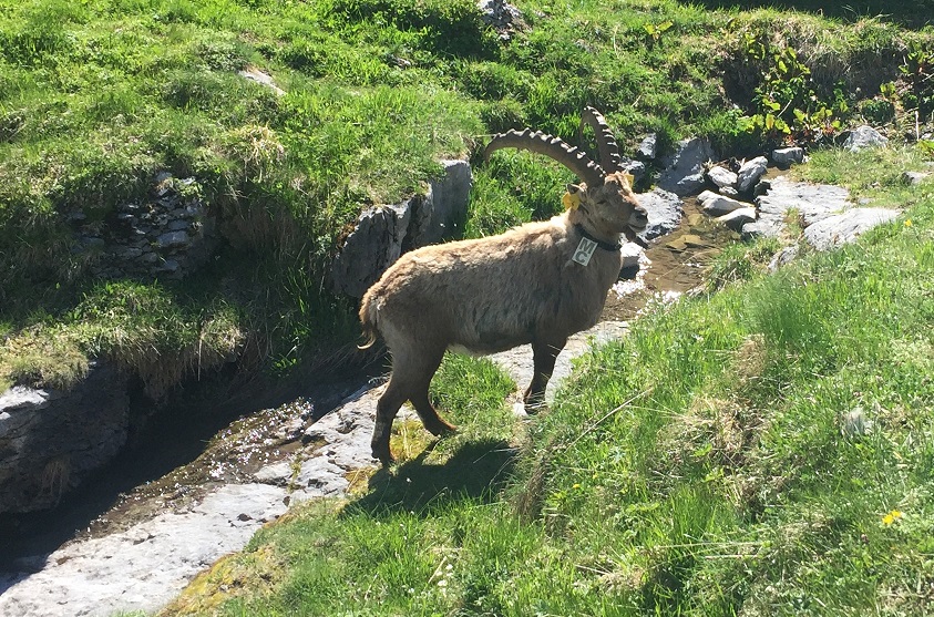
Another firm favourite with the Alps Accommodation team, and for good reason! Head to Sixt and then follow signs for the Cascade du Rouget and carry on past the waterfall (however you'll definitely want to take a few pics!) until the road ends at Le Lignon. Park here and follow the signs towards the 'Refuge de Sales' as the path winds through a narrow valley littered with numerous highly impressive waterfalls. It is common to see all kinds of wildlife in this area including chamois, marmottes, bouquetin (ibex), and bearded vultures. The walk ends at the refuge where refreshments (and beds if required!) are available. Return via the same route.
Time: 6hrs
Altitude Gain: 1078m
This is a long circular walk taking you from Sixt all the way up to the Refuge de Grenairon, which at almost 2000m, offers some of the best views in the area. Starting from Salvagny, follow the signs for the 'Refuge Grenairon' initially on wide forest track, before becoming a good, easy to follow walking trail. The trail winds up above the ski area of Sixt, offering increasingly beautiful views down the Giffre valley towards Samoens, eventually taking you to the refuge where well earned food and drinks are available. Grab a drink and take in the magnificent views towards Mont Blanc! To descend, follow the wide track with signs pointing towards 'Salvagny'.
Time: 5-6hrs
Altitude Gain: 968m
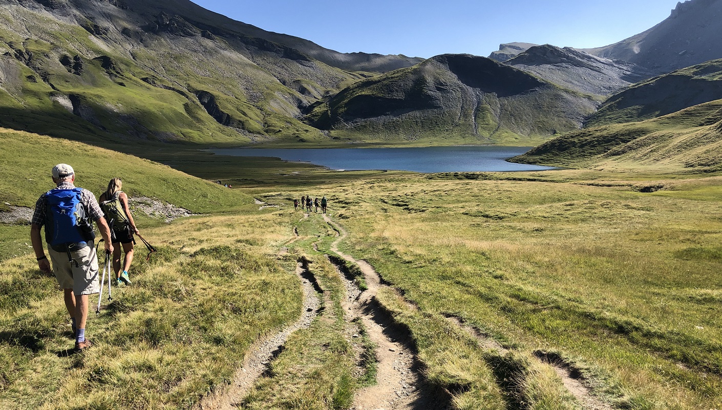
Starting in the same location as the 'Refuge de Sales' walk and initially following the same route, you then branch left and follow signs towards the 'Refuge Alfred Wills'. This walk rises up to a beautiful plateau resting below the stunning cliffs of the Chaîne des Fiz. This truly peaceful area has a real 'wild' feel to it, and is home to more marmottes than you could possibly photograph! From the refuge there are several options including returning via the same route, or climbing a little higher to either the Lac d'Anterne (for a swim!) or Col d'Anterne (for stunning views of Mont Blanc). Our pick would be to climb a little higher to the Petit Col d'Anterne for incredible views of Le Buet, and then descending via the Refuge de Fonts. This route generally follows good, well signposted walking paths with the occasional section of loose rock.
Time: 5hrs
Altitude Gain: 1209m
This is a fantastic walk climbing up behind the majestic Criou mountain and ending at a fascinating high altitude lake. Starting from 'Parking du Cret' above Samoens, follow signs up to the Refuge de Folly where lunch or refreshments are available. From here, follow signs leading under enormous cliffs towards 'Lac de Chambres' and look out for the giant ice blocks which signal you have arrived at the lake. During the winter a layer of ice, often well over 10m thick, forms on the surface of the lake but when the summer comes the lake drains away through a series of cracks in the limestone rock, and we are left with an impressive series of creaking ice blocks. From the lake, either return via the same route, or there is also the potential to carry on towards the Pointe de Bellegarde which offers stunning views from it's rocky peak (allow an extra 3hrs).
Time: 10hrs (overnight option available)
Altitude Gain: 2290m
The lofty summit of The Buet offers staggering views, and probably the best views there are of the Mont Blanc Massif. With an exposed and vertiginous summit ridge equipped with cables, this is a route for experienced hikers. Starting from Salvagny in Sixt-Fer-a-Cheval, it is certainly possible to tackle this monster in one day but a more 'relaxed' option is to spend a night at the wonderfully scenic Refuge Grenairon. A good, well signposted path takes you beyond the refuge to the summit of La Cathédrale, but beyond this navigation becomes a little more tricky. The rocky terrain beyond the refuge is home to many Bouquetin, so have your cameras ready!
Time: 4 days
Should you wish to take on something a little longer than a one or two day day hike, then look no further. This four day route can start/end in Sixt Fer a Cheval with it's circular route looping around the mighty Mont Ruan and passing through France and Switzerland. Each day of the walk conveniently ends at a mountain refuge where a comfy bed, evening meal and breakfast await! Needless to say, a high level of fitness and experience is required to navigate this wild and remote terrain. More info can be found here.